
So, how does a garden variety thunderstorm turn into a violent, scary and sometimes dangerous cloudfest that may end up throwing hail and tornadoes?
While all the updrafting of hot, moist air is happening inside a thunderstorm, it is also spitting cold, dry air out its back end. This happens because the hot air being sucked into the updraft shoots very high into the atmosphere, where it’s very cold. As the air cools, it sinks.
This is called rear flank downdraft or RFD, and it can be very, very strong—sometimes near 90 mph! As you can imagine, when this hits the ground, it rapidly spreads out and can knock over silos, small buildings and high-profile vehicles—including RVs. So you don’t even need to be hit by the most obvious front part to be in danger from severe thunderstorms.
At the same time, there may be shear present in the air above the surface. Shear is wind aloft that blows sideways. The shear can start parts of the cloud spinning horizontally, forming a tube of sorts. If part of that tube is hit by strong updrafts, it may tilt to a diagonal, eventually going completely vertical. At that point, it becomes a mesocyclone (persistent, strongly rotating updraft), located toward the center of the storm. This is when a storm evolves from a garden variety strong storm into a supercell.
Supercells
Supercells are rare, but are responsible for a remarkably high percentage of severe weather events, including tornadoes, extremely large hail and damaging straight-line winds. Meteorologists don’t yet know why some supercells produce these events, and others don’t. This is why we experience so many forecast “busts” for severe storms and tornadoes, but I think you’ll agree that it’s better to be safe than sorry.
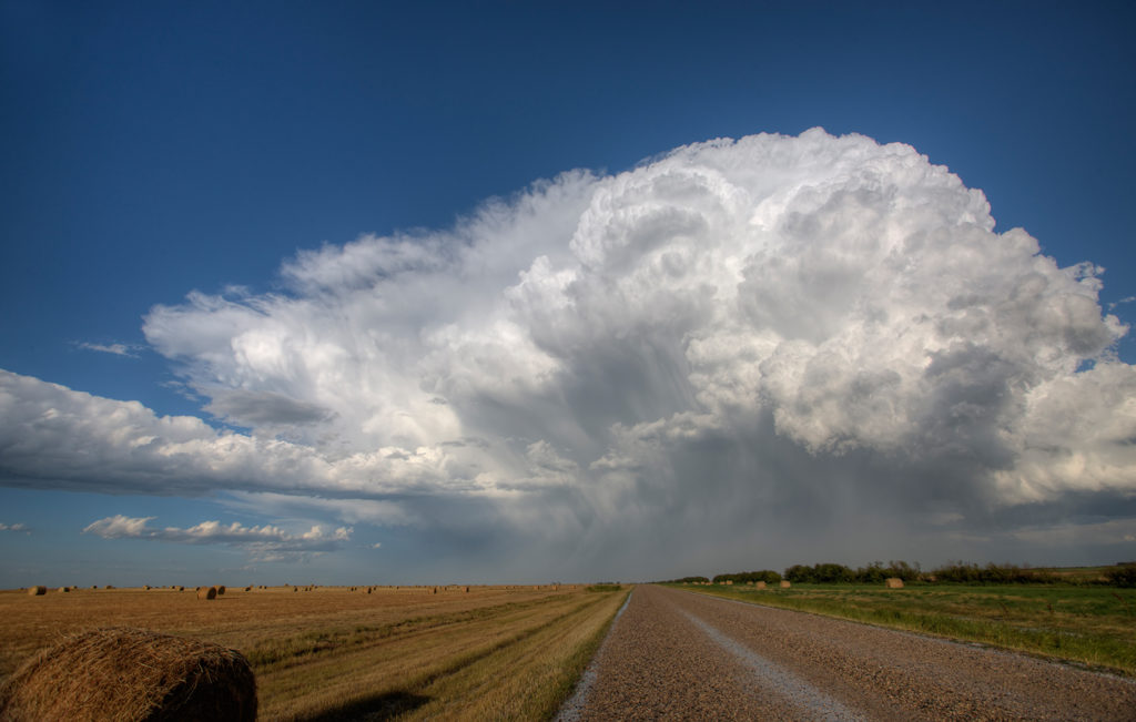
Many folks describe mature supercells as looking like the mushroom cloud from a nuclear explosion, and in many cases, it’s an apt description. Visual characteristics of a supercell often include
- a rain-free base (with or without a wall cloud)
- tail cloud
- flanking line
- overshooting top, and
- back-sheared anvil
All of these elements are normally observed in or near the right rear or southwest part of the storm. For definitions of the terms in the list above, go to the NWS Weather Glossary.
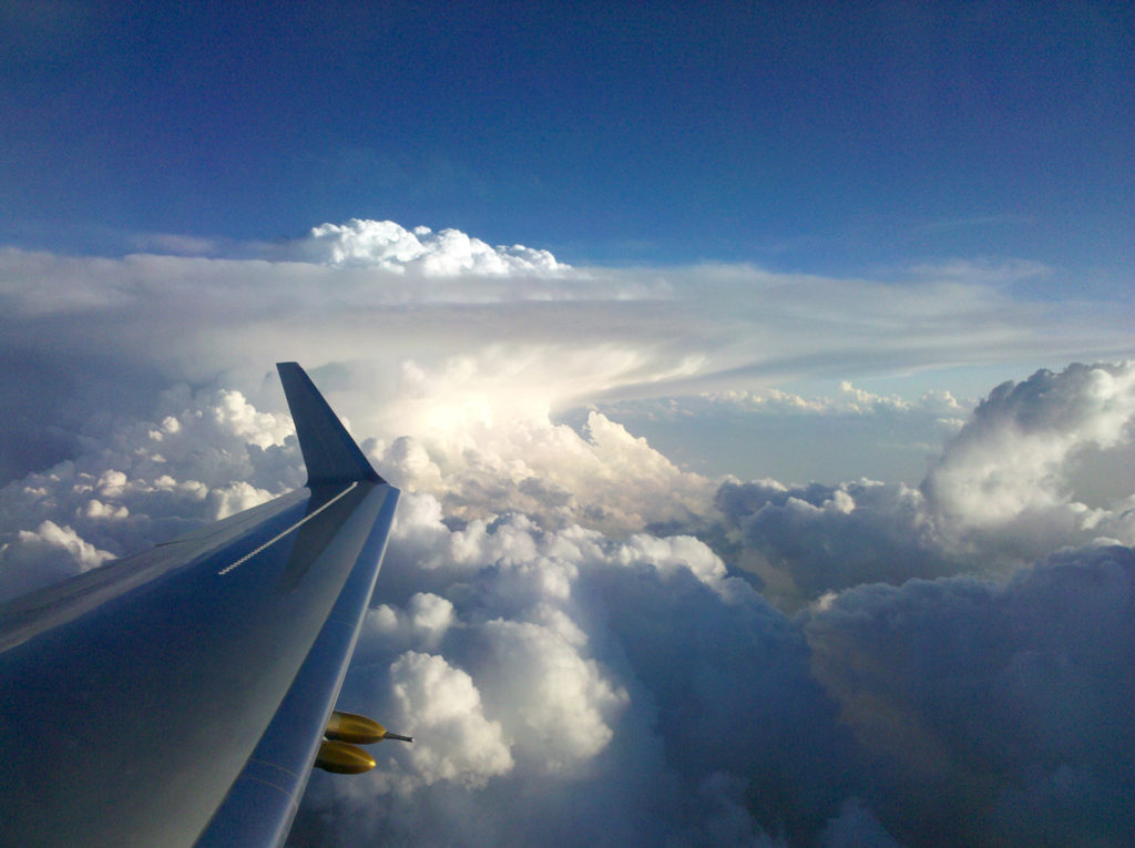
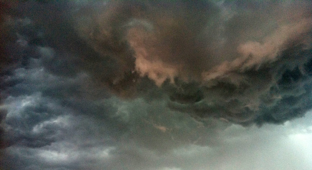
This photo from NASA shows a classic supercell that has hit the tropopause, flattened out, then whose embedded mesocyclone grew so powerful, it “broke the cap.” That bubbling area in the middle is the overshooting top.
If you know where to look, it’s easy to see when a storm has grown strong enough for its updrafts to “break the cap.” When the central updraft overwhelms the ability of the cold air layer above to hold it down any longer, the middle of the storm cloud begins to bubble up. You can’t see it if you’re underneath the cloud, but from a distance, that telltale bubble is quite obvious. Scientists refer to this bubble as “the overshooting top,” mentioned above.
Supercells frequently travel to the right of the main environmental winds (i.e., they are right movers). Rarely, you may encounter a left mover, so you can never really be sure which side of the storm is “safe.” So, as far as RVers are concerned, there is no “safe” side of the storm. Just stay away from them if you can. Their radar signature may often (but not always) include a hook, which represents the mesocyclone.
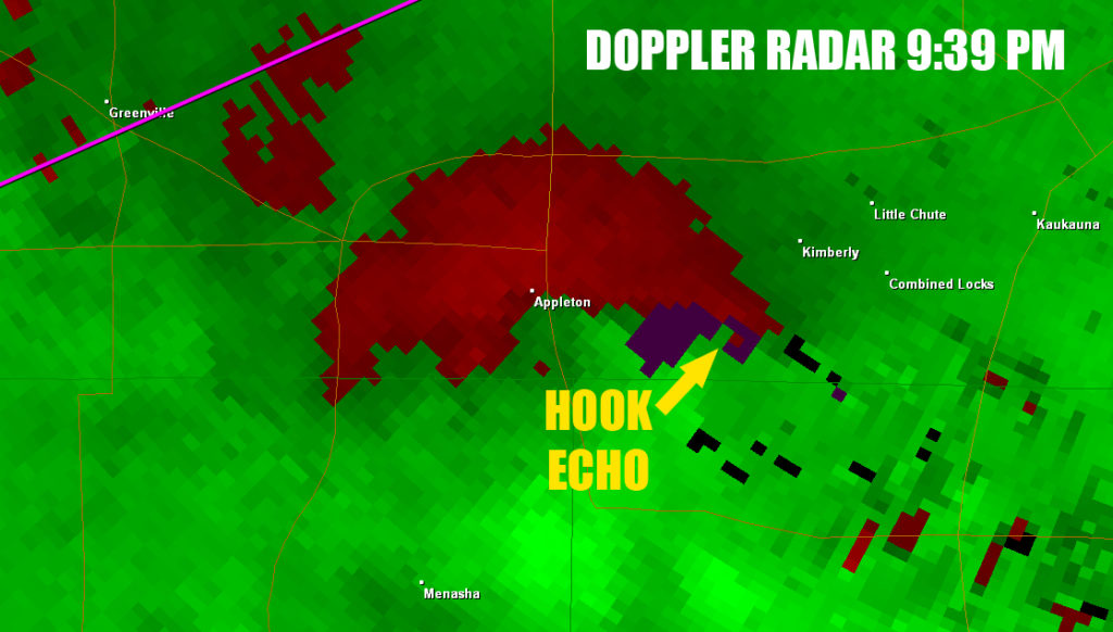
This is a screen grab from a Doppler radar signature, showing a hook echo that indicates the existence of a mesocyclone, or persistent rotating updraft, in a supercell. These can often indicate the presence of a tordnado. In this case, it was.
RVers, if you look at a radar and see a hook, set the radar in motion to see which direction that storm is moving in. If you’re in your RV on the road moving away from that cell, continue in the same direction and keep your eye on the storm. If you’re heading toward it, pull over as soon as possible and let it pass by if you’re at a safe distance.
If not, or if you notice it is heading for you, drive away at a 90° angle from it, so it won’t overtake you if you happen to not be traveling fast enough. Better possibly having to backtrack than having a tornado pick you up and deliver you to your truly final destination. The way you know if a storm is headed directly toward you: It appears not to be moving left or right, but is growing larger.
You may notice that the supercell in the above radar signature is a single, lone cell, rather than one embedded in a long squall line. These discrete, single cells are more dangerous because they keep all their energy in one spot, while a squall line of many embedded storm cells have to share their energy with each other. While a line does throw an occasional tornado, you’re far more likely to see one drop from a single cell. The image below shows both types of supercell storms.
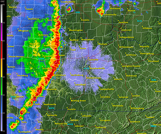
This is the Doppler radar signature of a squall line, which rides out ahead of a (usually cold) front. Even if you’ve never seen one of these before, it’s pretty obvious it doesn’t represent anything good headed your way. But the more dangerous storm in this image is the small, discrete supercell just out in front of the squall line, at the top.
There’s a lot more detailed explanation of supercell formation and behavior, along with illustrations, here.
More:
- RV Weather – Main Page
- RV Weather – Severe-Prone Areas of the U.S.
- RV Weather – Recognizing Severe Weather Conditions
- RV Weather – Weather Awareness and What To Do
- RV Weather – How Severe Weather Develops
- RV Weather – Types of Clouds to Watch For
- RV Weather – Hurricanes and Tropical Systems
- RV Weather – Snowstorms, Blizzards and Other Winter Stuff
- RV Weather – Smartphone Apps
- Current Severe Weather Alerts for Nomads – My Facebook Group
Recent Comments