
One of the things I hadn’t really thought about before I got on the road full time was how much time I would have to spend planning driving routes. This was particularly challenging last year, during my first year as a fulltime nomad, because I had to learn how to do this along with the many other aspects of living this lifestyle.
Plus, not realizing how much it would eat into my productive work time, I was traveling a lot more then, at least every two weeks.
Nomadic Route Considerations
Some things most travelers don’t have to think about that RVers must consider:
- Steep grades – If even close to driving an under-powered tow vehicle with trailers or fifth wheels, or an older, less-than-robust Class C such as the Toyota Sunbird, steep grades can present challenges ranging from sweaty-palm nervous-making to downright dangerous. And that’s just going uphill. Coming down a steep grade can test the best of braking systems.
- Low clearance – bridge overheads/hanging vegetation/wires – Since many trailers and motor coaches are taller than even pickup trucks, we have to get used to thinking about being able to safely clear any over-the-road structures ahead.
- Narrow roads and bridges – These can prevent us from being able to safely go where we wish, because many RVs are wider than standard, consumer-grade autos and trucks.
- Weight-restricted bridges – Once a nomad starts living in anything larger than a teardrop trailer, total vehicle weight becomes an issue when driving rural backroads and tiny towns, whose bridges may not support commercial-weight combinations or motorcoaches.
- Potential need to turn around ahead – If we DO get ourselves into a situation where we can’t continue forward progress, we must always give ourselves the space to turn around and head back the other way. Unfortunately, the very scenarios that prevent forward movement almost always preclude a safe turnaround, and most RVers, no matter how skilled, will tell you that backing up their rigs isn’t their favorite thing to have to do. Having to back up for long distances is just downright scary.
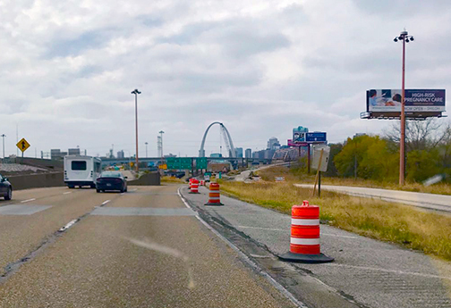
- Certain construction areas – We also have to think about trying to avoid construction areas with very narrow lanes (“cattle chutes”) that might squeeze our wider-than-usual RVs, effectively preventing forward motion.
So, despite the spirit of freedom to just take off and go where the wind blows us, it’s important that we take some care to know what the road ahead of us holds. The importance of this knowledge is in direct proportion to the size of our rigs, because the taller/wider/heavier they are, the more places they won’t be able to fit.
Mitigating Factors in Destination Choices
Realizing these issues, I quickly got on board with using online tools and mobile apps to help me plan my routes.
If I’ve been sitting a while in one place, I will usually do my route planning a week before I expect to get on the road. If I’m enroute on a longer trip, I will generally re-evaluate the next day’s plan after I’ve gotten off the road for the night.
I remain flexible in this task for two main reasons: Either I’ve made better time than expected or not gotten as far as I’d hoped; or the weather is changing in an unexpected way. The former will cause me to have to choose a new overnight spot to maximize my progress or make up for lost time (if I’m on a hard schedule, which is rare)
I’m sharing here the current tools in my arsenal. There are many more, but I only feel qualified to talk about those I have used myself:
Route-Planning Apps and Web Tools
Coverage – PAID App. Because I sometimes need to get online to work after I’ve gotten off the road for the day, the first requirement of any place I stop is to have cell service. I also want to be able to check my email, log in to my social media accounts, check the weather ahead and often, tweak my original route plan. This means that in addition to other considerations listed here, I also choose my overnight spots according to my ability to get online while I stay there. This awesome little app from the wizards at Technomadia gathers service coverage maps for the continental U.S. from the major cell phone providers. It also allows the ability to toggle the overlays on and off, to zero in on areas where you’re most likely to get the best quality signal. Caveat: These overlays are only as good as the accuracy of the coverage maps generated by the cell service providers. If you’ve been on the road for any time, you’ve likely discovered that in more remote areas (and surprisingly many less-remote ones!), these provider maps are more wishes or fantasy than expressions of actual fact. As a general rule, if you find yourself in a “bowl” area of any sort, formed by a ring of mountain, ridges or sometimes even low, rolling hills you wouldn’t think would be a problem, you are very likely to experience signal drought.
Radius Around A Point – FREE Website. Because I try to hold myself to 4-5 hour trips for safety (I tend to fall asleep at the wheel if I drive too long) and comfort (I’d rather avoid having to find an overnight spot in the dark), I tend to limit my trips to 200-250 miles a day. This website helps me easily determine the potential destinations within that distance. Not great instructions, but it’s pretty intuitive. Caveat: The creator no longer supports it, and the map looks like it won’t work anymore, but it does. Just proceed as though the ominous-sounding disclaimer isn’t there.
RV Trip Wizard – ANNUAL PAID SUBSCRIPTION Website. This popular tool lets you enter your location and destination, then maps a route with campgrounds, gas stops and other points of interest. Estimates trip cost with gas and campground fees, lets you set driving times and distances, and customizes results to your rig.

Roadtrippers – FREE Website & App. Again, enter where you want to start and finish your road trip, then discover the coolest “off the beaten path” places along the way. Their database includes millions of the world’s most fascinating places, making planning the unexpected easier than you thought. They also have a paid Plus version, which gets rid of ads, lets you collaborate with friends, and build seriously long trips.
Steep Route USA – FREE Website. This is just an interactive map that has symbols on it showing seriously steep grades that big rigs and RVs might find challenging. Click on each symbol to learn which road it’s on, then click that label to get a detail-level map. If you look ahead on the road and see a daunting-looking peak, it might be a good idea to visit this site.
Flattest Route – FREE Website. Very straightforward and easy to use. Simply type in your current location, your destination, and the flattest route will be mapped out for you on the Google Earth map below. If that route doesn’t suit you, you can drag start/end points to find another route.
Mountain Directory – The Mountain Directory books, ebooks and apps give the locations and descriptions of over 700 mountain passes and steep grades in 22 states. They tell you where the steep grades are, how long they are, how steep (%) they are, whether the road is two-, three-, or four-lane, whether there are escape ramps, switchbacks, sharp curves, speed limits, etc. You can get an Eastern and a Western version, or a combined format, which is what I bought. You have to download a proprietary PDF reader called Javelin (I guess to prevent piracy) to your mobile device, then upload your PDF file to your mobile, as well. Takes a bit of tech knowledge, but having had the shit scared out of me more than once by significant steep routes I would have had difficulty avoiding by the time I encountered them, I was happy to pay the fee, which was around $30 when I bought it. There is also an Android app, but I have an iPhone so haven't tried it.
There are other trip planning websites and apps that I use primarily during active weather situations. I have listed and described those here. And I’ve also listed other driving apps here, which you may or may not consider route planning tools.
I hope you find some of these tools useful in planning your own trips. For those of you who are more seat-of-the-pants travelers (or “pantsers”) than planners, I will offer this advice: I am more of a pantser in most facets of my life. I have always resisted planning of any kind, believing it took the spontaneity out of everything. And generally, I still subscribe to this outlook. But when it comes to RV travel, I have become an avowed planner. Between weather, inaccurate information, and road mishaps, I find that even the most well-planned trip is open to all kinds of spontaneity (whether you want it or not). That’s more than enough for me.
One Last Tool…
Oh, and one last bit of advice? Regardless all this wonderful modern technology, I still travel with a detailed, up-to-date, print-format road atlas. Because generally, if you get into an area where you feel lost, that will be just the place you realize you have no cell reception to use GPS. So, as the old adage goes: Trust Allah, but tie your camel. Use technology as you can, but have an old-fashioned, reliable backup. I’ve yet to use mine, but it gives me great peace of mind to know I have it if I need to.
Happy road-tripping!
DISCLAIMER: I am not being paid to feature any specific products in my blog posts. I share product information for whose who may want to use them in your own RV or other home. I do offer Amazon portals that allow you to purchase them easily, as I did. As an Amazon Associate, I will make a very small commission if you buy through these portals, but the purchase won’t cost you anything extra. I only feature products I have used myself or that I have personally seen successfully used by people I know. If you do choose to buy through these portals, please know how much I appreciate your support.
Thanks for information. Not on road but most interested in it just for traveling for trips.
Glad the site can be of service to you, Mary! Check back every so often, as I add tools occasionally when I discover and try them out. Keep the shiny side up!